Solo Trip 2005
Part Four......
|
---
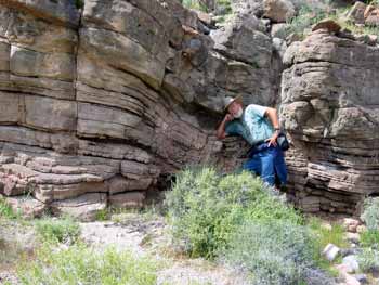
I am starting to get weighed down with my heavy thinking and pondering and relentless search for the Indian cave nobody talks about!! During the past three weeks I have invested eight days and nights and hiked over thirty miles looking for the cave. It has been good exercise and interesting country but towards the end the hikes were ranging out five miles, spending four hours of climbing and searching the canyons and five miles back to the Vanagon. I was becoming one tired puppy!!
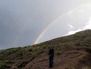
Yet, there is always the hope I might find it at the end of the rainbow. And finally....
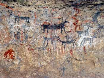
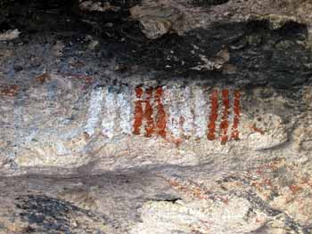
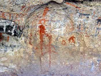
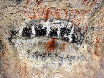
I did!!! Pictographs! Painted Indian Art!
Deer and sheep and other markings I have no idea about.
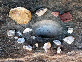
Even a base rock metate and various rock chips!
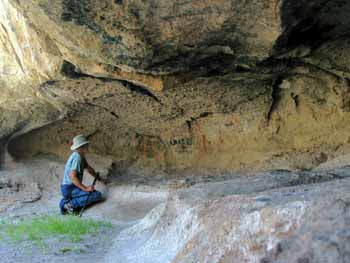
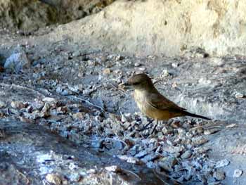
And, of course, a Say's Phoebe building her nest in a cavity in the ceiling!! I returned the next day to do a watercolor of some of the art and even knowing where it is located I still ended up going the wrong way! This cave is an amazing puzzle that even when solved isn't easy to find. And I am happy about that. There were no foot prints on the trail and none at the cave. I removed my footprints when I left. Best kept secrets are best..., kept secret.
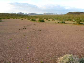
Another interesting object I encountered is what
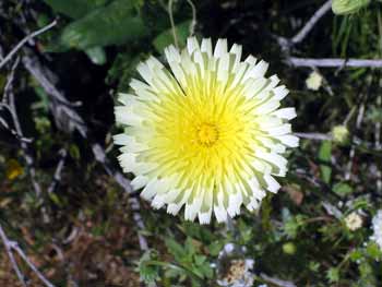
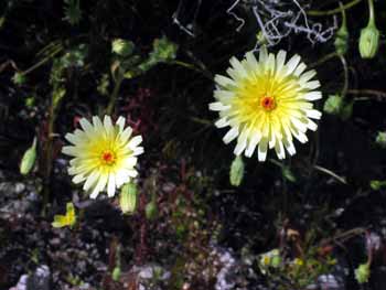
some call a Geolyth. And of course, the flowers.
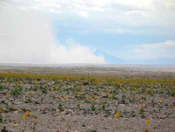
These caught my attention because there are thousands of yellow centered flowers, like the one on the left, but those with a red spot in the center are quite rare. March 22 I am now ready to tackle my next project and it is located in Panamint Valley, the next valley west of Death Valley.
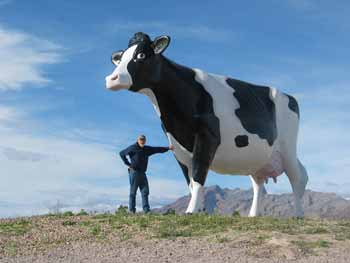
Crossing the Death Valley floor heading for the Panamint I notice the wind was kicking up huge clouds of dust in the Badwater area. I got out my Kestrel wind gauge and clocked wind gusts to 40 mph with an average of 35 mph! Thousands and thousands of daisies blowing in the wind. When I arrived at Stovepipe Wells the wind slacked off and I saw the vehicle of my dreams!
Oh boy, oh boy, if I ever win the lottery.........
Well...... If cows could fly......... Actually, with a huge camper like that I would never
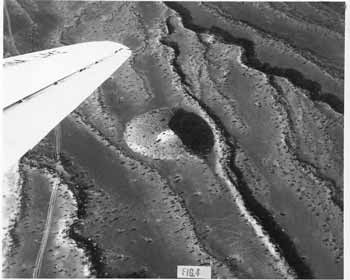
get into the places I go with my Vanagon. So, now. What's my current quest? I want to see if I can find the crater in Panamint Valley.
This photo was taken from an airplane in 1947 when it was first discovered!
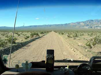
I have the Lat. and Long. loaded into my computer and my GPS giving me direction. So, somewhere up ahead....
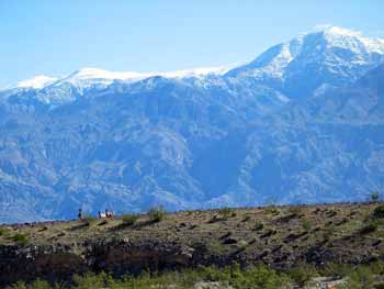
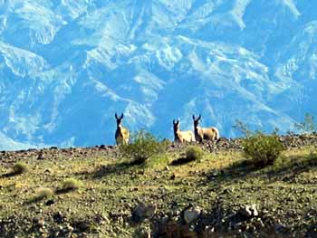
Aw shucks. I can't do anything without somebody always watching!! There are three burros in the left photo with Telescope Peak in the background. I stopped the vehicle, got out and walked towards them whistling and making weird noises hoping to keep their curiosity until I could get close enough for a better picture. The right photo is as close as I could get. This is the first time I have ever seen wild burro in this desert. So, anyway. Back to my quest.
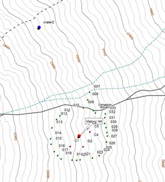
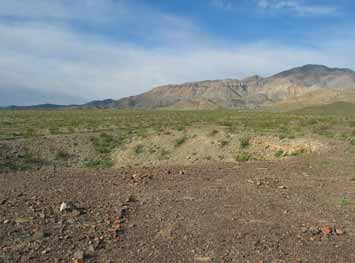
Here is my topo map and the red dot is where my coordinates say the crater should be. I drive up the dirt trail that is just to the north of the red dot and got within about .3 miles. I get out my GPS and walking stick and hike to the location. Nothing there. I started walking around the area trying to find it. C1, C2, C3, C4 and C5 are the waypoints I log in my search. Nothing. I go back to the Vanagon and have lunch. I decided to walk around the red dot at a radius of approximately one quarter of a mile. That is what all the other numbers, 010 through 033 are as I log waypoints around the red dot hoping to intercept the road the early investigators made.. I also search to the north out to 007. Nothing. Hmmm. I notice I have cell coverage so I call my Brother in Seattle and my friend Eddie in Fort Bragg, CA. and leave messages with them asking them to check the website and see if they can come up with better coordinates. With in an hour Eddie calls back and gives me new coordinates which indicated the crater should be .95 miles north/northwest of where I am parked. I marked that location with a Blue dot, (crater2). Yippee! I drive back down the road I had arrived on and take an even more obscure trail which is the dotted line across the north west corner of the above map but... I am finally able to drive right to the crater!
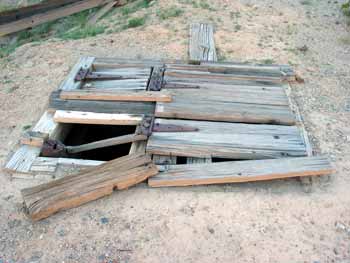
This is my attempt to stitch two photos together of the crater.
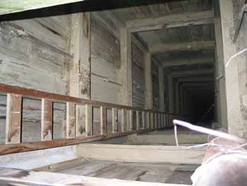
Down in the center of the crater is the old
exploration shaft. Hinged boards covering the shaft in the left
photo
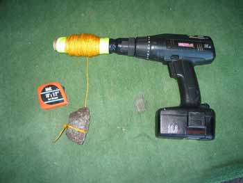
Of course my inquiring mind wants to know how far down, down is. Here is my research equipment. One nice rock for weight, some nylon cord, my cordless drill (don't you always carry a cordless drill around with you?) and my tape measure. I used electrical tape to tape the roll of nylon cord to the chuck on the drill. Soon I had my answer. The shaft is 88 feet deep!
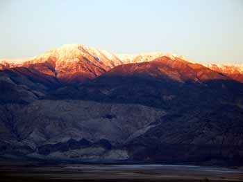
I camped overnight by the crater and watched a spectacular sunset on Telescope Peak in the Panamint range.
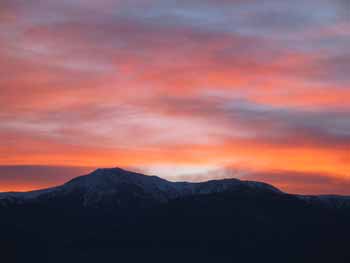
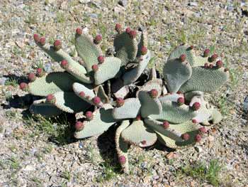
And a spectacular sunrise in the morning! I notice the cacti buds are swelling.
I mention this so my friends Ed and Suzanne and my wife Lolli, who are coming to the desert April 17th, will know that there should still be flowers happening. Meanwhile, while waiting for my friends to arrive I guess I will go into Pahrump, do some grocery shopping, fill my water tank, do my laundry and up-load this latest chapter of my ongoing Solo Trip, and then go find some other quest to pursue. Stay tuned for Part Five. The adventure will continue.
|

For more information about the Panamint Crater go to this website:
http://www.meteorite-times.com/Back_Links/2002/October/Bob's_Findings.htm
Click here for Part Five, the story continues